Property Record
Bandol Dr, Hoschton, GA 30548
NEARBY LISTINGS FOR SALE OR LEASE
Property Detail
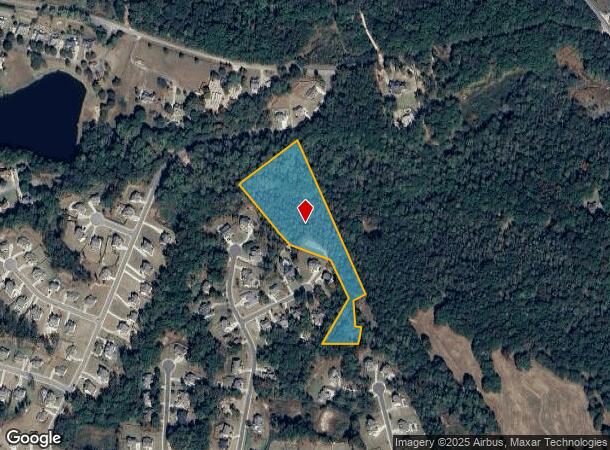
Bandol Dr
Atlanta-Sandy Springs-Roswell, GA
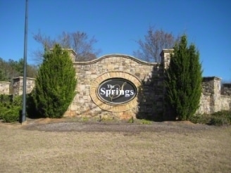
Double Bridges Farms
XX026G-075
OPEN SPACE 8.043 AC SPRING OF CHATEAU
Residentialacreage
Barrow
A
Georgia
13013C0050D
res
2024
7.20 AC
2024
Barrow County
010106
Atlanta
DEMOGRAPHICS near Bandol Dr
1 Mile
3 Mile
5 Mile
2024 Total Population
1,315
16,925
58,228
2029 Population
1,563
19,866
67,333
Pop Growth 2024-2029
+ 18.86%
+ 17.38%
+ 15.64%
Average Age
43
39
39
2024 Total Households
477
5,666
19,479
HH Growth 2024-2029
+ 18.87%
+ 17.35%
+ 15.52%
Median Household Inc
$92,622
$107,589
$96,775
Avg Household Size
2.80
3.00
3.00
2024 Avg HH Vehicles
2.00
2.00
2.00
Median Home Value
$279,818
$336,794
$336,342
Median Year Built
2004
2005
2004
Nearby Places
Map Layers
Map Styles
 Street
 Aerial
- Restaurants
- Banks
- Shops
- Fitness
- Groceries
Nearby Properties
Address
Land Use
TOTAL SIZE
Lot Size
Zoning
Address
Land Use
TOTAL SIZE
Lot Size
Zoning
979,317 SF
107.36 AC
001
Address
Land Use
TOTAL SIZE
Lot Size
Zoning
381,371 SF
77.30 AC
PUD
Address
Land Use
TOTAL SIZE
Lot Size
Zoning
160,277 SF
53.40 AC
PUD
Address
Land Use
TOTAL SIZE
Lot Size
Zoning
613,440 SF
50 AC
003
Address
Land Use
TOTAL SIZE
Lot Size
Zoning
510,720 SF
48.46 AC
M1
Address
Land Use
TOTAL SIZE
Lot Size
Zoning
521,290 SF
23.60 AC
MD
Address
Land Use
TOTAL SIZE
Lot Size
Zoning
502,088 SF
36.80 AC
MD
Address
Land Use
TOTAL SIZE
Lot Size
Zoning
422,920 SF
24.70 AC
MD
Address
Land Use
TOTAL SIZE
Lot Size
Zoning
500,500 SF
53.92 AC
MI
Address
Land Use
TOTAL SIZE
Lot Size
Zoning
805,954 SF
52.41 AC
003
Address
Land Use
TOTAL SIZE
Lot Size
Zoning
547,250 SF
47.51 AC
M1
Address
Land Use
TOTAL SIZE
Lot Size
Zoning
554,285 SF
70.18 AC
Address
Land Use
TOTAL SIZE
Lot Size
Zoning
42,053 SF
40.90 AC
PUD
Address
Land Use
TOTAL SIZE
Lot Size
Zoning
222,000 SF
20.59 AC
003
Address
Land Use
TOTAL SIZE
Lot Size
Zoning
240,946 SF
21.51 AC
004
Address
Land Use
TOTAL SIZE
Lot Size
Zoning
76,566 SF
10.30 AC
PUD
Address
Land Use
TOTAL SIZE
Lot Size
Zoning
76,792 SF
19.31 AC
003
Address
Land Use
TOTAL SIZE
Lot Size
Zoning
28,282 SF
6.36 AC
C2
Address
Land Use
TOTAL SIZE
Lot Size
Zoning
8,752 SF
11.40 AC
OI
Address
Land Use
TOTAL SIZE
Lot Size
Zoning
572.63 AC
004
Address
Land Use
TOTAL SIZE
Lot Size
Zoning
51,710 SF
2.20 AC
GC
Address
Land Use
TOTAL SIZE
Lot Size
Zoning
128,874 SF
11.57 AC
001
Address
Land Use
TOTAL SIZE
Lot Size
Zoning
224.76 AC
004
Address
Land Use
TOTAL SIZE
Lot Size
Zoning
65,501 SF
2.20 AC
GC
Address
Land Use
TOTAL SIZE
Lot Size
Zoning
56,085 SF
R3
Address
Land Use
TOTAL SIZE
Lot Size
Zoning
173.05 AC
004
Address
Land Use
TOTAL SIZE
Lot Size
Zoning
81,900 SF
8.61 AC
001
Address
Land Use
TOTAL SIZE
Lot Size
Zoning
13,800 SF
5 AC
PUD
Address
Land Use
TOTAL SIZE
Lot Size
Zoning
43,094 SF
107.98 AC
PUD
Address
Land Use
TOTAL SIZE
Lot Size
Zoning
21,696 SF
1.01 AC
PUD
The World's #1 Commercial Real Estate Marketplace
Connect with us
© 2025 CoStar Group
The information above has been obtained from sources believed reliable. While we do not doubt its accuracy we have not verified it and make no guarantee, warranty or representation about it. It is your responsibility to independently confirm its accuracy and completeness. Any projections, opinions, assumptions, or estimates used are for example only and do not represent the current or future performance of the property. The value of this transaction to you depends on tax and other factors which should be evaluated by your tax, financial, and legal advisors. You and your advisors should conduct a careful, independent investigation of the property to determine to your satisfaction the suitability of the property for your needs.